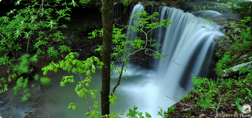

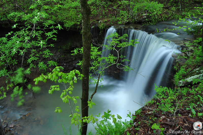
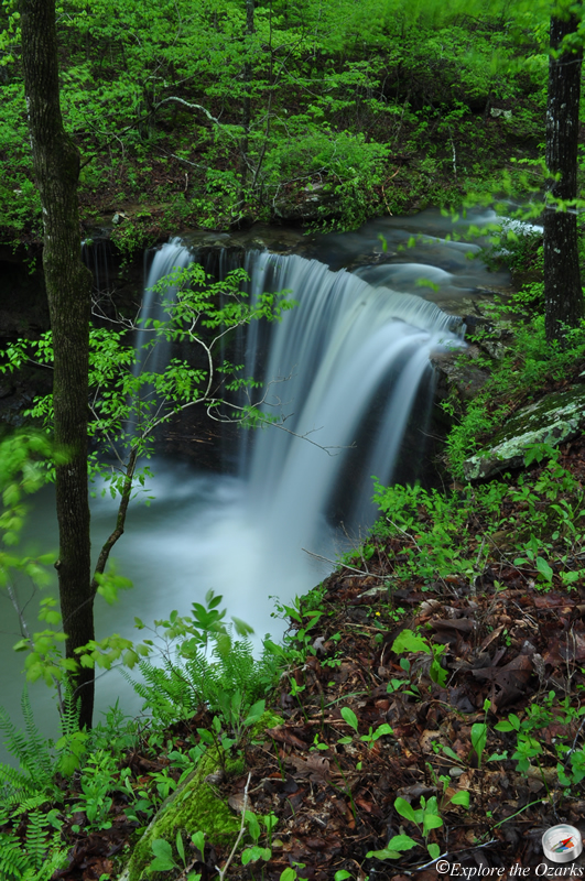


The Basics
- Height: 18'
- GPS: N35 53.037, W93 28.210
- USGS Quad: Boxley
- Distance: 0.35 miles One-Way
- Difficulty: Moderate Bushwack
- Location: Ozark National Forest
- Ranger District: Big Piney
- Sub-Location: Upper Buffalo Wilderness
- Region: Arkansas Ozarks & Boston Mountains
Details & Directions
Amber Falls is located in the Upper Buffalo Wilderness of the Ozark National Forest, and is found on Whitaker Creek, just upstream from Compton's Double Falls. I am going to describe the route to take to get to both waterfalls. There is no designated trail, but it is a fairly easy bushwack to get to them. The park area is located on Cave Mountain Road, just past the trailhead for the Hawksbill Crag Trail.
To get to the trailhead, take AR Hwy 43 south from the town of Ponca, until you reach the intersection with AR Hwy 21. Turn Left and continue south through Boxley Valley for 1.2 miles, crossing over two bridges, and then Turn Right onto Cave Mtn Road (steep gravel road), which is just before the bridge that crosses the Buffalo River. Zero your odometer here. Travel up Cave Mountain Road, passing the Cave Mountain Church at 5.4, and the Hawksbill Crag trailhead at 6.0 miles. Continue Past the trailhead for another 1.1 miles, until you come to a right-hand curve in the road, and a wooden sign on your Left that says "Upper Buffalo Wilderness" and Park along the side of the road.
Head into the woods behind the sign (on the left/south side of the road) and start bushwacking straight down the hill. A small drainage should be just to your right, and you will want to follow this all the way down to Whitaker Creek. Once you hit Whitaker Creek, Turn Left and follow the creek downstream, coming to Amber Falls almost immediately.
To get to Compton's Double Falls, continue to follow Whitaker Creek downstream, but staying on the bench up above, keeping the creek just off to your right. You will pass two small drainages along the way, each containing small waterfalls. After about ¾ mile, you will reach the falls; the creek will drop sharply and you should be able to hear the falls, too. It takes a lot of water to get this waterfall running as a double, so save it for a really rainy day. To return, hike back out the same way that you came in.