


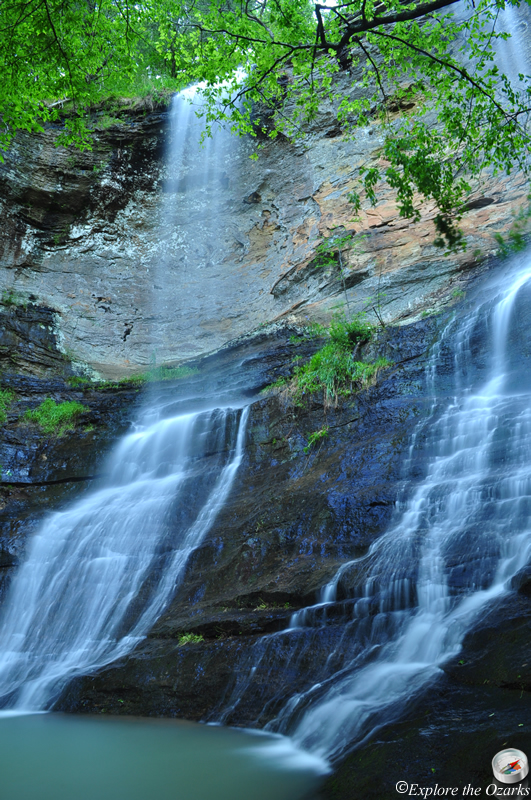


The Basics
- Height: 71'
- GPS: N35 40.846, W93 41.216
- USGS Quad: Yale
- Distance: ¼ mile One-Way
- Difficulty: Easy Bushwack
- Location: Ozark National Forest
- Ranger District: Pleasant Hill
- Region: Arkansas Ozarks & Boston Mountains
Details & Directions
When the water is running high, this beautiful waterfall is definitely worth the trip! Located across from the High Bank Canoe Access on the Mulberry River, few people have actually ever seen these falls, since they are not visible from the road.
To get here, take AR Hwy 23 north from the town of Cass, then Turn Right onto AR Hwy 215. Follow this highway 9.2 miles, then Turn Right into the High Bank Canoe Access, which is well marked. Park here.
From the parking area, head back out to the road, Turn Right, and cross a stream that is on your left, then leave the road To The Left. Follow this creek, bushwacking your way upstream. You will cross a small stream on your right, then the falls will be another 100 yards or so ahead.